Paplatelės pažintinis takas
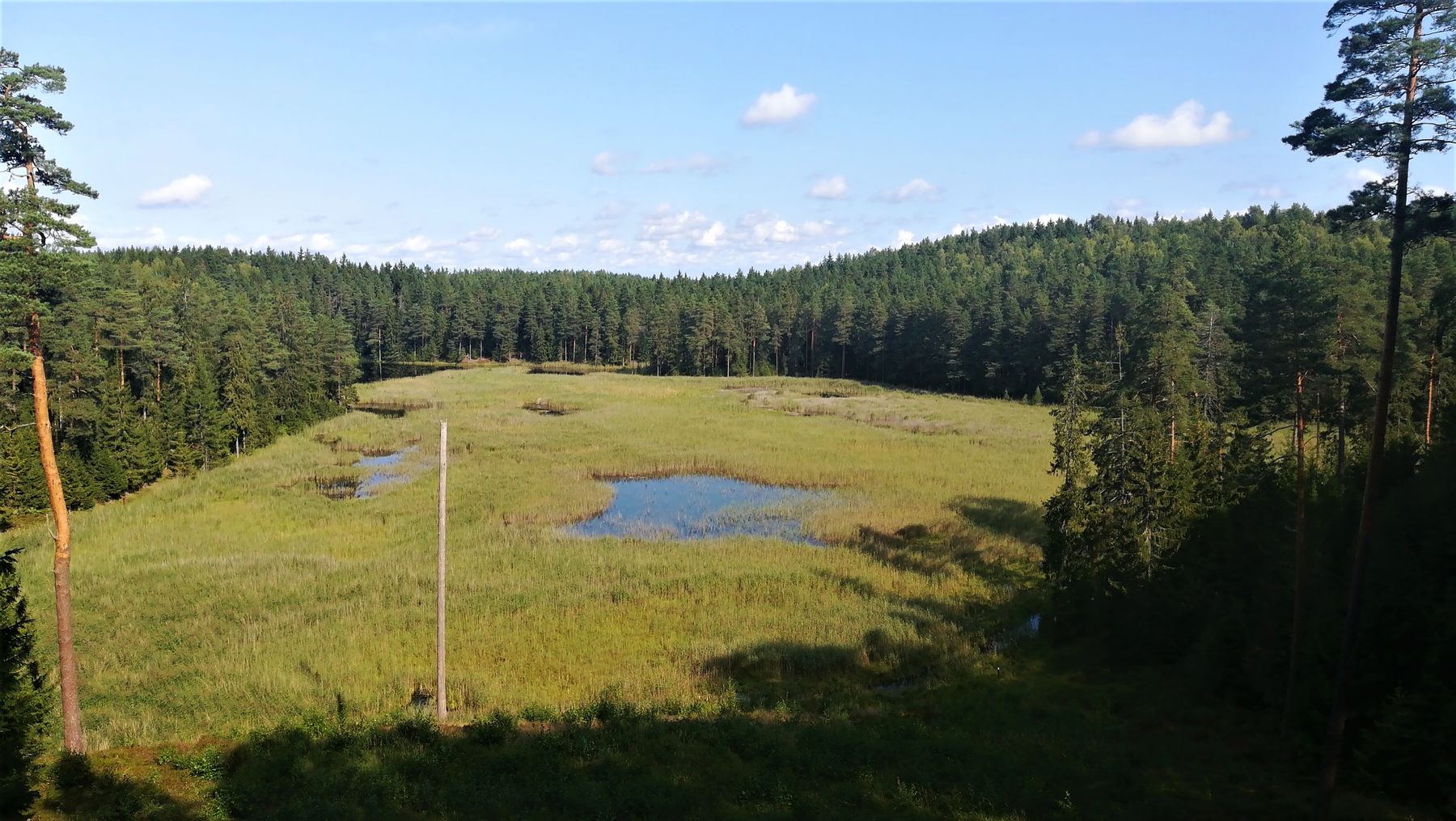
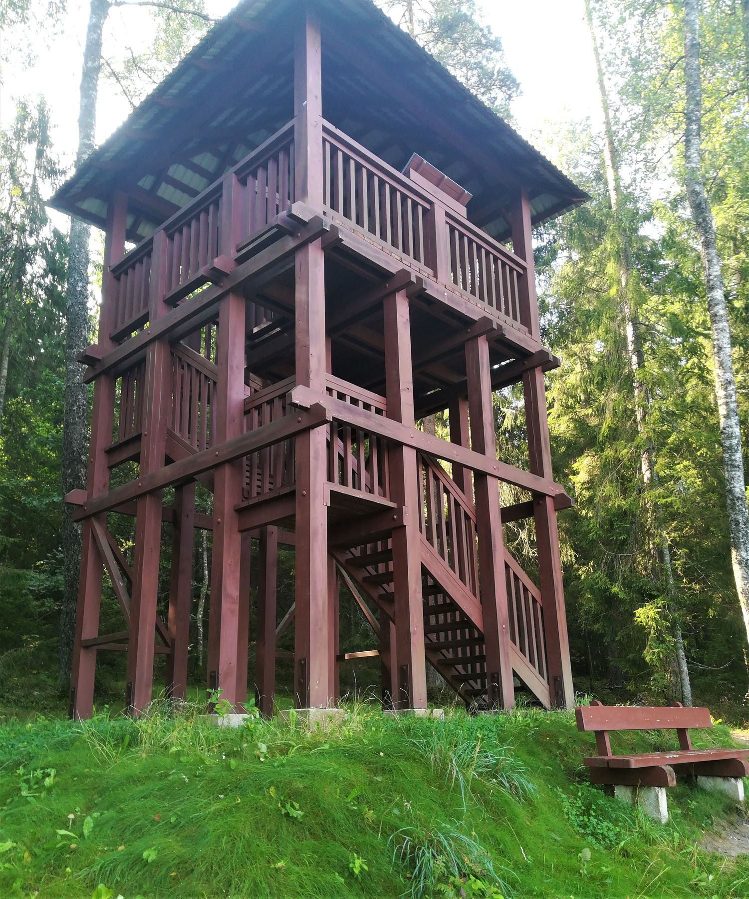
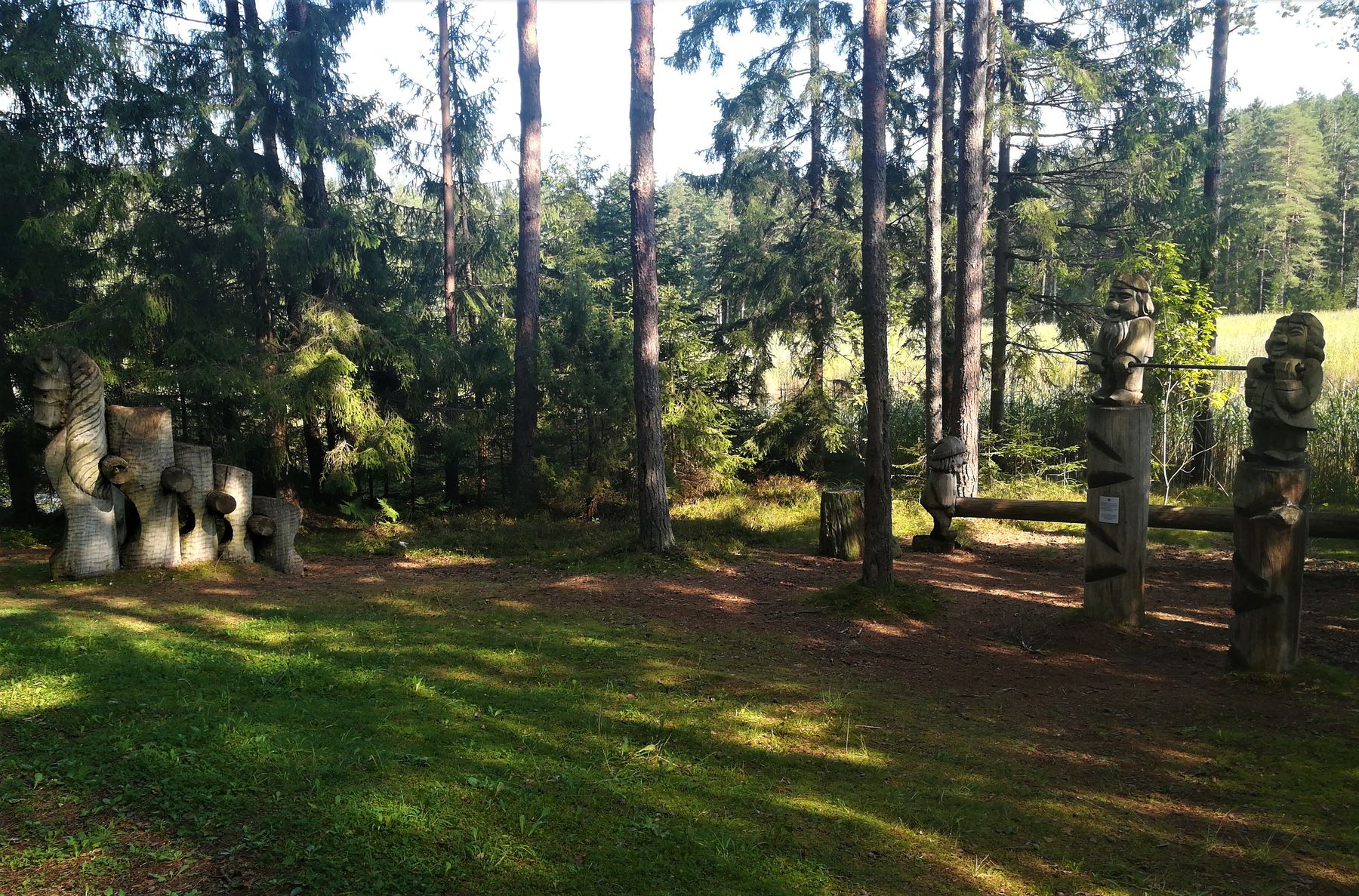
Paplatelė educational walking trail is located in the Žemaitija National Park on the eastern shore of Lake Plateliai, in the village of Paplatelė, 8.9 km from the Visitor Centre in Plateliai. The walking trail is meandering on woody hills and the shores of the Sultekis pond. A playful appearance of the trail is created by wooden sculptures, while the viewing tower overlooks the pond and spruce forests encircling the pond. Tourists will have the opportunity not only to see but also sense the hilly relief of the Žemaitija National Park, which is immensely picturesque along this trail. The relief of Paplatelė neighbourhood was formed by the last glacial period some 13-13,5 thousand years ago. The hills reach a height of 189 m above sea level. This trail is the only one in the National Park where wooden sculptures, created following motifs of Lithuanian fairy tales, have survived from 9th decade of 20th century. Several sculptures are tailored to meet needs of agile children and those who seek active rest. The trail runs its first 300 m through the Woodland Key Habitat (WKH). This is a wooded area not affected by economic activity, or affected at the slightest extent, in which one may come across to some endangered, vulnerable and to be protected rare species of plants, fungi and animals. The habitat existing here is attributed to the type of pine forests and mixed woods with single pines, with the area of 10.5 ha and century-old pines and spruces. The trail meanders through the Sultekis pond, formed in the eight decade of the 20th century, which slowly becomes a swamp. Here, you can see or listen to Honey buzzard (Pernis apivorus), Marsh Harrier (Circus aeruginosus), Common buzzard (Buteo buteo) and other species of birds. At the edges of the pond, protected Common spotted orchids (Dactylorhiza fuchsii) grow. Also, you can see here paths in the woods made by moose, roe deer, wild boars, hollows hammered by birds of woodpecker family and anthills. The trail has way finding signs, and there is an Information Board at the starting point. The trail is built with several types of paving: natural (0.6 km), hard packed soil (1.3 km) and asphalt (0.4 km). The trail is only adapted for hiking, Nordic walking, suitable to travel with children (without strollers).

Info
Type: TrailLength: 2.5km
We visited: 05 Aug, 2018
GPS: 56.046841, 21.885817